


Geocaching Série caches Curcy #

albers
User
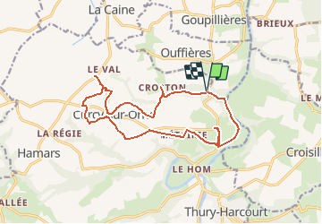

Length
15.3 km

Max alt
213 m

Uphill gradient
303 m
Km-Effort
19.4 km

Min alt
23 m

Downhill gradient
297 m
Boucle
Yes
Creation date :
2018-04-17 18:34:06.817
Updated on :
2018-04-17 18:34:06.817
30m
Difficulty : Easy

FREE GPS app for hiking
 SityTrail
IGN / Geographical institutes
SityTrail Plus
The world is yours!
About
Trail Other activity of 15.3 km to be discovered at Normandy, Calvados, Le Hom. This trail is proposed by albers.
Description
Geocaching
série de 23 caches la bonus
Points of interest


Positioning
Country:
France
Region :
Normandy
Department/Province :
Calvados
Municipality :
Le Hom
Location:
Curcy-sur-Orne
Start:(Dec)
Start:(UTM)
684125 ; 5432123 (30U) N.
Comments